|
Home |
Who Are We |
Finance Companies |
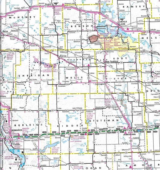
North Dakota Map
114 Ac Benson Co. Crop Land For Sale
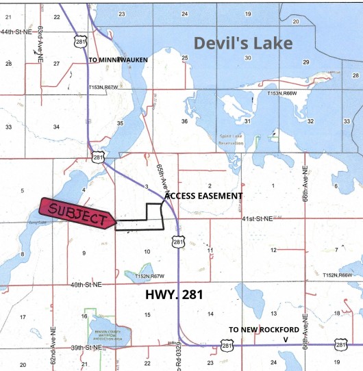
Lallie & Oberon Townships, Minnewaukan, Benson County, North Dakota
Easy Access off Hwy 281 on an Access Easement in the NE Corner of this Highly Productive 114 Acres of Cropland boasting Class II Soils with a 69.9 Productivity Index Overall in Beautiful Rolling Topography as an Agriculture Investment Ready to Plant this Spring or as a Land Holding with Dependable Income from a Good Renter, this Land definately stands out. Phenominal Recreation of Upland Game, Large Game and Waterfowl in this area. Please enjoy a DRONE VIDEO of this Land. Seller's Asking $370,000 or $3,246/ac avg.
*********************************
Legal Description: SW1/4 SE1/4 (Less 5.75 Ac) Section 3, N 873' of Lot 4 and N 873.83' of Lot 1 & N 873.83' of NW1/4 NE1/4 Lying W of RR RW in Section 10, All in Township 152 North, Range 67 West according to the Benson County Treasurer Tax Statement consisting of 113.87 Acres in Benson County, North Dakota with Sellers reserving Oil & Gas Rights currently owned, if any.
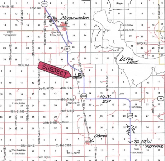
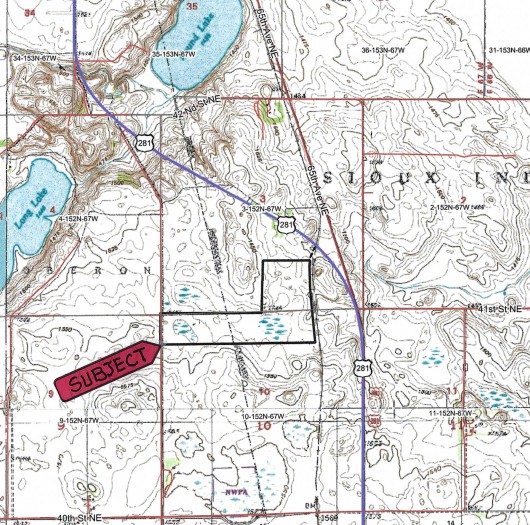
Location: From Minnewauken, ND travel South on Hwy. 281 for 4 Miles to the NE corner of the Subject Land (See Map). There is a recorded Access Easement for Landowner to Access Property off Hwy. 281.
Acreage Breakdown:
91.62 +/- Acres of Tilled Farmland, Balance 22.25 +/- Acres in Wetlands.
Easements: There are NO USFW Grassland Easements on this Land, however there IS a USFW Wetland Easement which does not intere with Agriculture but restricts burning, draining, leveling or filling Wetlands without permission from USFW.
Annual Income: There are NO Ag Leases on this Land and it is Ready to Plant this Spring. There is also a Good Renter (Seller's Son) available to Lease the Land if new Owner chooses.
Real Estate Taxes: Most Recent Real Estate Taxes available are $895.21/year or $7.86/acre avg. which includes 5% Discount for payment by February 15th. There are NO Special Assessments on this Property.
Note: FOR A DRONE VIDEO TOUR OF THIS PROPERTY, PLEASE CLICK HERE.
Seller's Asking $370,000 or $3,246/ac avg.
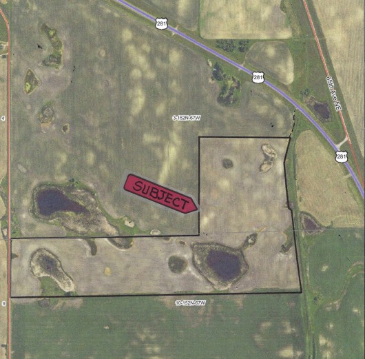
Aerial Map of Subject Land Outlined in Black
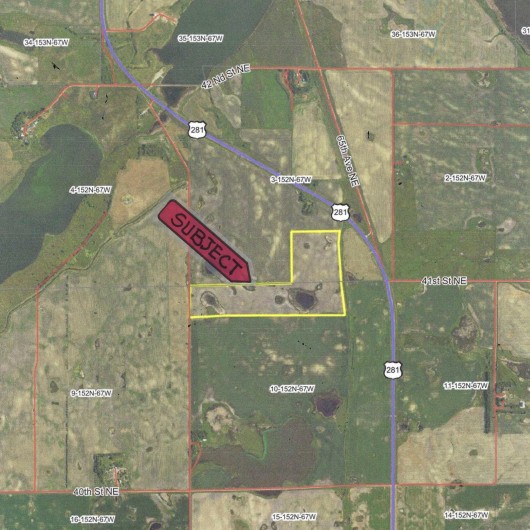
Aerial Map of Subject Land Outlined in Yellow showing Surrounding Area
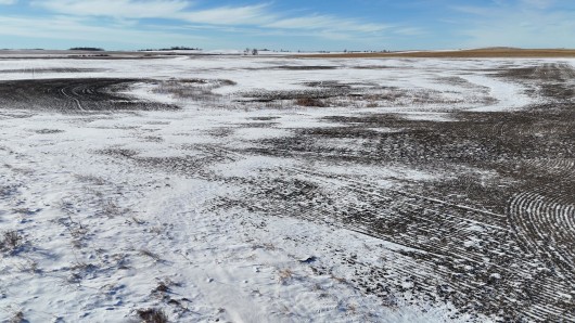
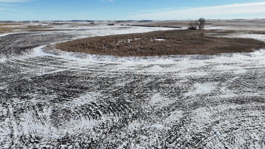
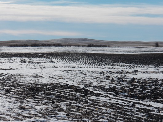
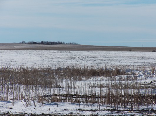
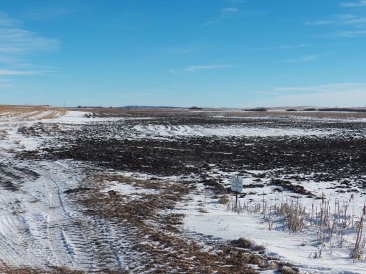
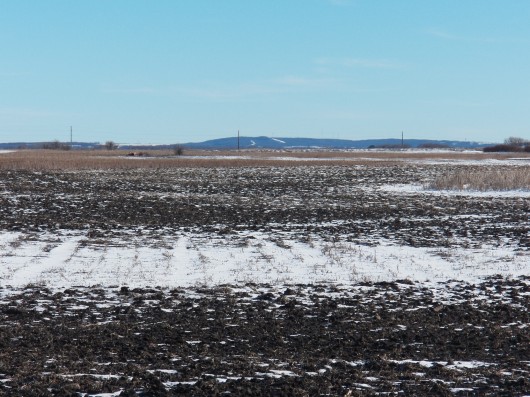
Drone View from the NE corner looking SW
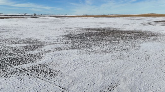
Another view from the Drone from the W side looking E
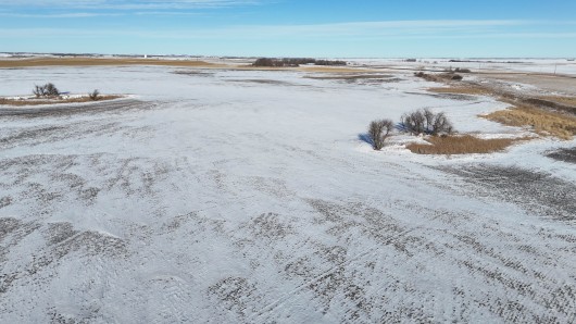
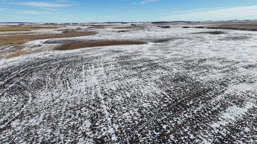
Drone view from the SE corner looking N
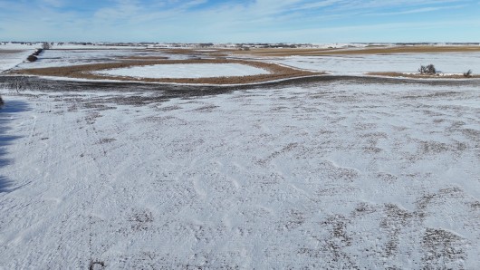
Another view from the Drone in the SE corner looking W
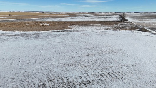
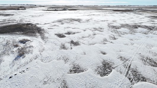
Drone view from the SW corner looking E
Another Drone view from the W side along 63rd Ave NE looking E
Another Drone view of the SW portion of Property
Drone view from the far NW corner of Property looking S
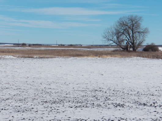
View of Property from the NE corner
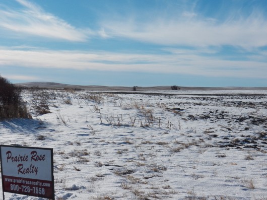
View of Property on the W side from 63rd Ave NE
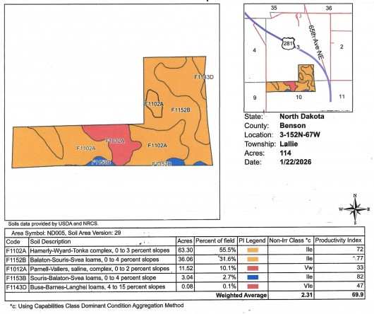
Soil Map and Legend of Subject Land
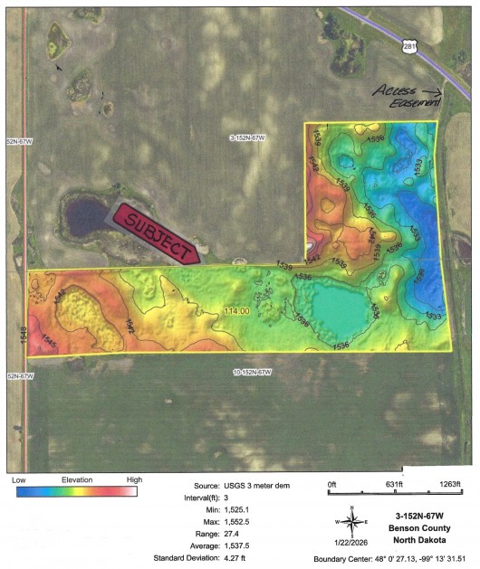
Hillshade Topography Map of Subject Land
Topography Map of Subject Land Outlined in Black
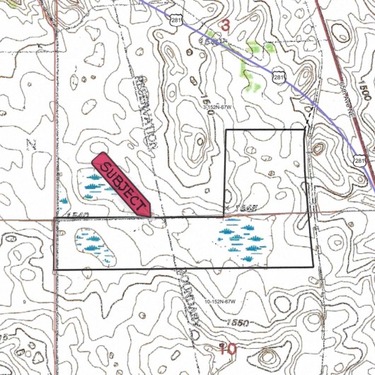
Topography Map of Subject and Surrounding Areas.
If you are interested in this property, please contact Prairie Rose Realty Inc. at landbroker@bektel.com or call 701-475-2784 or toll free 800-728-7558.
Prairie Rose Realty Inc. is representing the Sellers in this transaction. All information has been gathered from sources considered reliable, however cannot be guaranteed by Prairie Rose Realty Inc.
|