|
Home |
Who Are We |
Finance Companies |
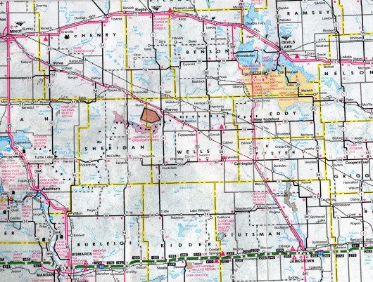
North Dakota Map
164 Ac Harvey Crop & Pasture Land
Western Township, Harvey, Wells County, North Dakota
This Fertile 164 Acres +/- of Land located within 5 miles SW of Harvey, ND, has 130.6 Tilled Farmland Acres of Non-Highly Erodible (NHEL) w/62 Productivity Index of Class II & III Soils, and 31.85 Acres of Pasture with Good Fences and a Winding Creek passing through providing a Livestock Water Source Earning $9,060/year for 2026 Lease. A perfect slice of Serenity for the avid Outdoors Person near the LoneTree Wildlife Refuge. Please enjoy the DRONE VIDEO of this Land! HUGE PRICE REDUCTION to $398,000 or $2,427/ac avg.
REDUCED TO SELL!
*********************************
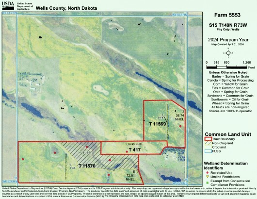
Legal Description: E1/2 SE1/4 EX 35.64 Ac, SW1/4 SE1/4 and S1/2 SW1/4 Section 15, Township 149 North, Range 73 West, Wells County, North Dakota as described on Abstract consisting of 164.36 Ac Reference: Wells Co. Tax Statement
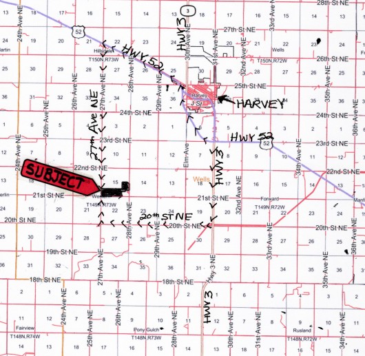
Location: From Harvey, ND at the Junction of Hwy's. 3 and 52, travel South on Hwy. 3 just 3 Miles to 20th St. NE. Turn West and travel 4 Mi to 27th Ave NE. Turn N for 1 Mile to SW corner of Subject Land - OR BEST ROUTE - From the Junction of Hwy's 3 & 52, follow Hwy 52 approximately 5 Miles to 27th Ave. NE. Turn South and travel 5 Miles to the NW corner of the Subject Land. (See Map) There is a gravel road the runs along the South side of the Property to the East side. It just doesn't go all the way East to Hwy. 3 due to water on the road.
Acreage Breakdown:
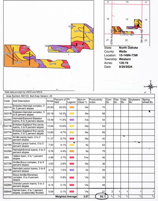
130.6 +/- Acres Tilled Crop Land with overall Productivity Index of 62.1. 31.85 /- Acres of Grassland/Pasture with Good Fences and Creek Water of Herbaceous Wetlands. Soil Productivity Index is 56.8 overall which includes Pasture and Creek Beds with Herbaceous Wetlands
Easements: There are NO USFW Wetland or Grassland Easements on this Land.
Annual Income: Land is Leased for 2026 with possible longer Leases. 130.6 Acres earning $62/Acre or $8,060.00 per Season and 31.85 Acres of Pasture Leased at $1,000.00 for the 2026 Season for a Total Income of $9,060.00 for 2026 Season. Sale is Subject to new Owners honoring these Leases.
Real Estate Taxes: Most Recent Real Estate Taxes available are $1,062.34/year or $6.47/acre average which includes 5% discount for payment by February 15th
Note: FOR A DRONE VIDEO OF THIS PROPERTY, CLICK HERE!
HUGE PRICE REDUCTION to $398,000 or $2,427/ac avg.
REDUCED TO SELL!
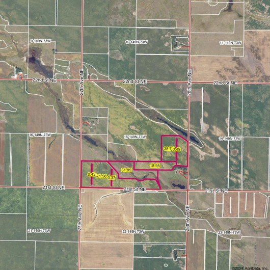
FSA Aerial Map of Subject Outlined in Red
Aerial Map of Section 15 with Subject Outlined in Red
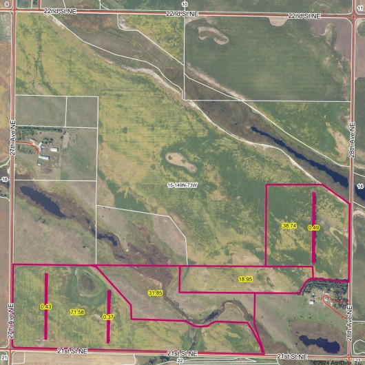
Aerial Map showing surrounding Acreage w/Subject Outlined in Red
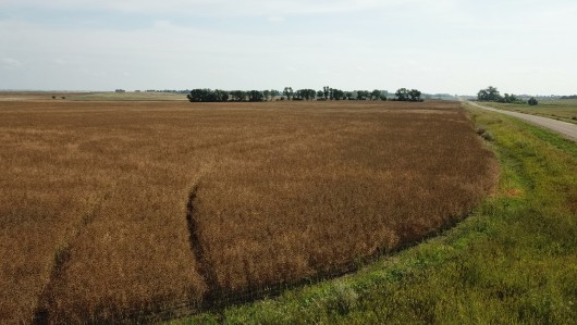
Drone View from the SW corner of Property looking E
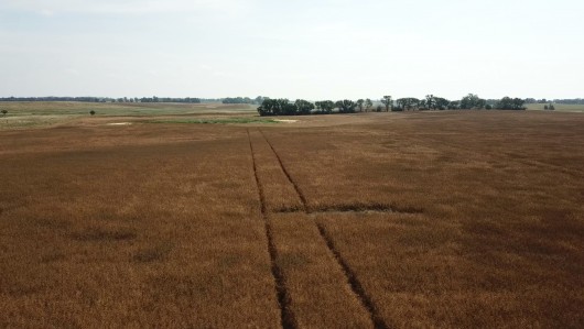
Drone View from SW corner looking N
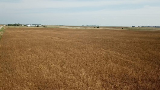
Drone View from the NW corner of Subject Property looking E
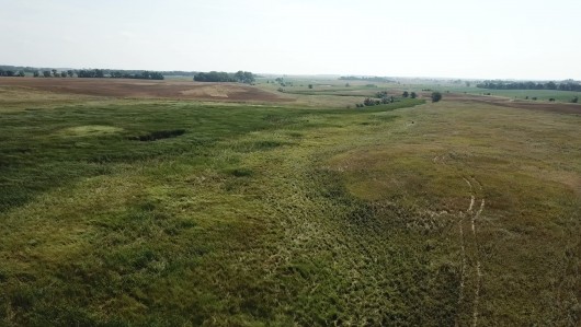
Bird's-eye view of the Pasture from the N side looking S
Drone View from the S side of the Pasture looking N
NW corner looking E
SW corner looking N
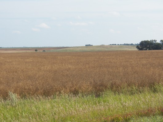
SW corner looking E
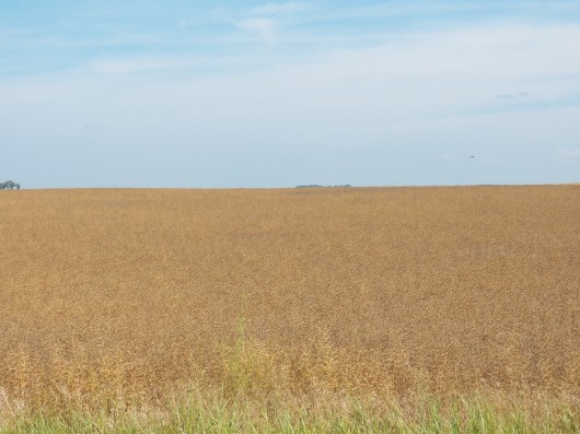
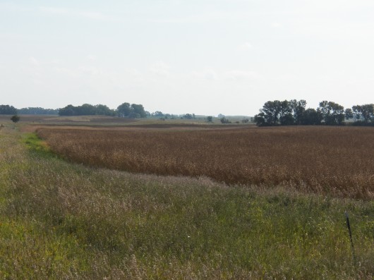
View of Cropland planted to Canola this season
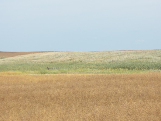
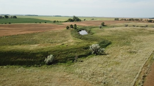
View of Cropland and Pasture
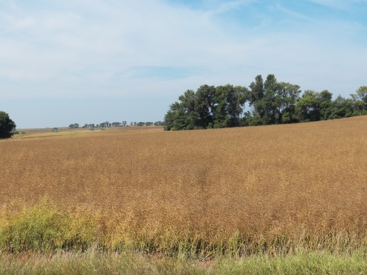
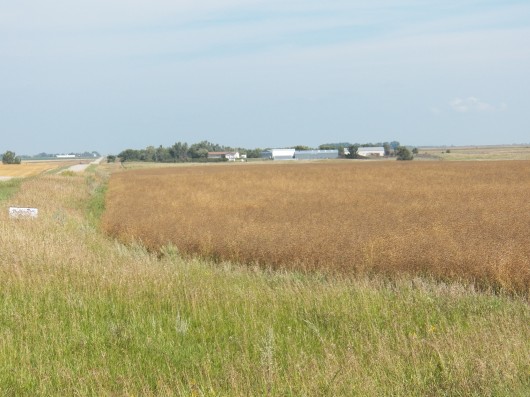
View from the E side of Property looking W
Soil Map & Legend for Cropland Acres
Hillshade Topography Map Subject Outlined in Black
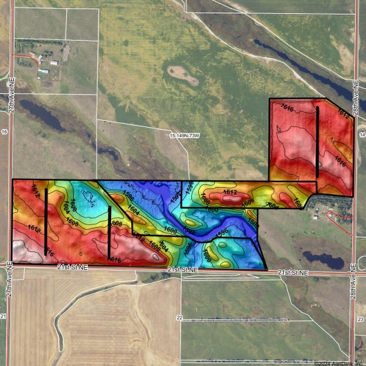
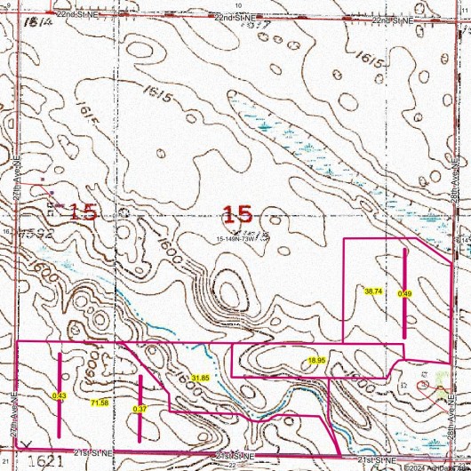
Topography Map of Section 15 w/Subject Outlined in Red
If you are interested in this property, please contact Prairie Rose Realty Inc. at landbroker@bektel.com or call 701-475-2784 or toll free 800-728-7558.
Prairie Rose Realty Inc. is representing the Sellers in this transaction. All information has been gathered from sources considered reliable, however cannot be guaranteed by Prairie Rose Realty Inc.
|