|
Home |
Who Are We |
Finance Companies |
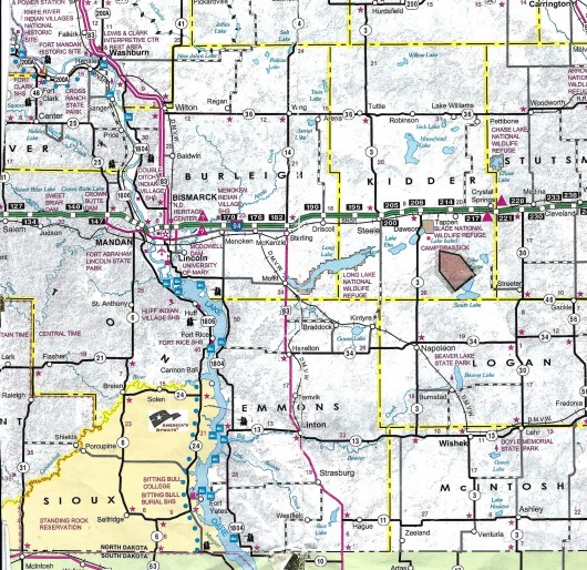
North Dakota Map
160 Ac Peace Twp. Ag Land For Sale
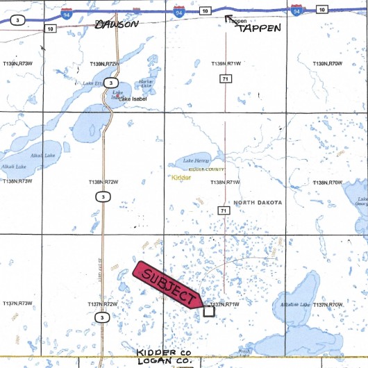
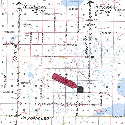
Peace Township, Tappen, Kidder County, North Dakota
160 Acres +/- of Diversified Land with 100 Acres of Cropland rotated w/Corn and Soybeans and the balance in Grass. There are NO USFW Wetland or Grassland Easements or Ag Leases to Honor on this Land, however there are Good Renters Available. The Location of this Secluded Quarter in Peace Township offers Great Hunting as a Bonus! Seller Asking $425,000 or $2,657/ac avg.
*********************************
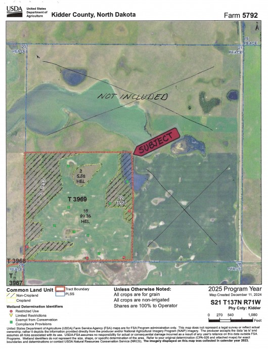
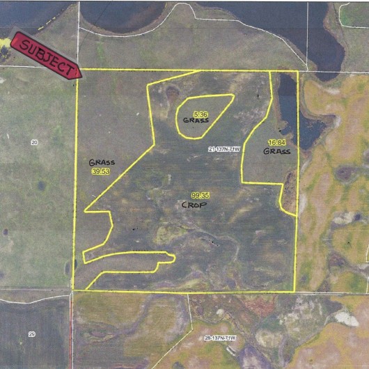
Legal Description: SW1/4 Section 21, Township 137 North, Range 71 West, Kidder County, North Dakota as described on Abstract w/Sellers reserving Oil & Gas Minerals currently owned, if any.
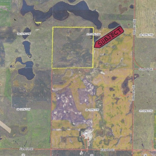
Location: From Tappen, ND at I-94 travel South on Hwy. 71 for 15 miles to 53rd Street SE. Turn West and travel 1 Mile, then North 1 mile on Section Line to SW Corner of Subject Land. - OR - From Dawson, ND at I-94 travel 15 Mi South on Hwy. 3 (or from Napoleon travel N on Hwy. 3) to 53rd Street SE. Turn East and travel 5 Miles to 38th Ave. SE, and 1 Mile North to the SW corner of Subject Land. (See Maps)
Acreage Breakdown:
99.35 Acres +/- of HEL Cropland.60.05 Acres +/- of Grass,
Easements: There are NO USFW Wetland or Grassland Easements on this Property.
Annual Income: There are NO Ag Leases to honor on this Property, however previous Renter was paying $80/ac for Cropland.
Real Estate Taxes: Most Recent Real Estate Taxes in 2024 were $625.39/year or $3.91/ac avg. per year which includes 5% Discount for payment by February 15th. There are NO Special Assessments on this Land.
Note: FOR A DRONE VIDEO OF THIS PROPERTY, PLEASE CLICK HERE.
Seller Asking $425,000 or $2,657/ac avg.
Plat Map of Subject Land
FSA Aerial Map of Subject Outlined
Close Up Aerial Map of Subject Outlined in Yellow
Aerial Map showing Access from South. Subject Outlined in Yellow
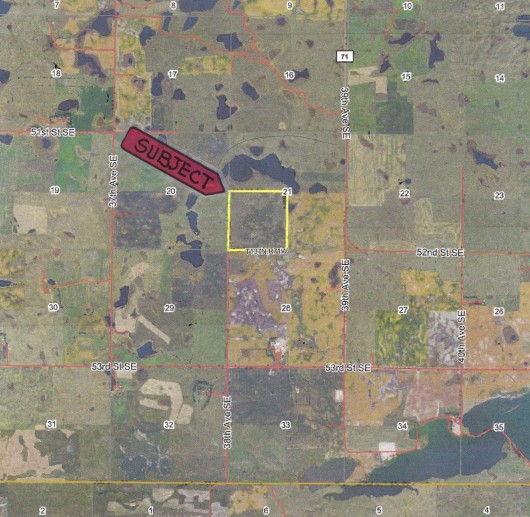
Aerial Map of Surrounding Acres w/Subject Outlined in Yellow
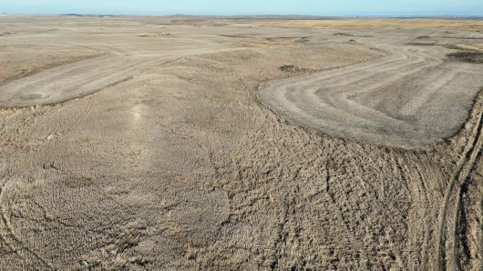
Drone view from the SW corner looking NE
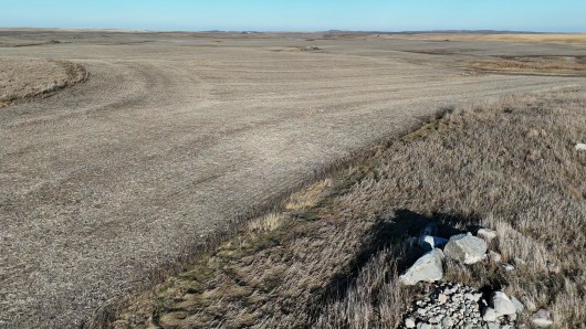
Aerial view from the W side of the Cropland looking E
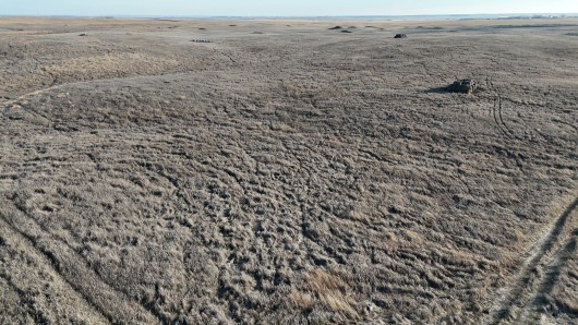
Drone view from the NW corner looking SE
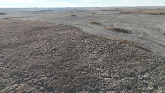
Drone view of Property from the NE corner looking SW
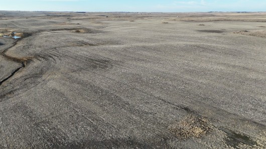
Drone view from the SE corner looking NW
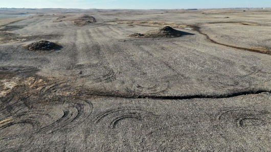
Another Drone view from the SE corner looking W
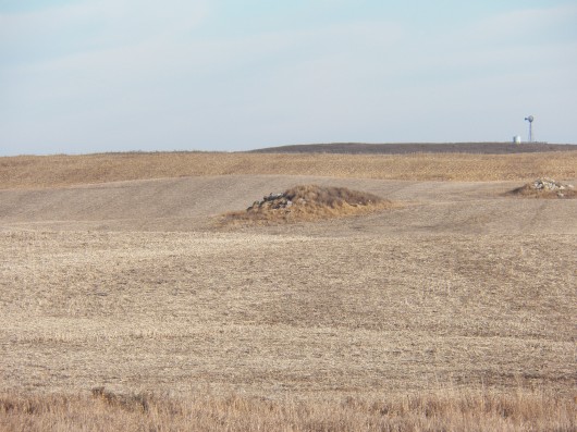
View of the Cropland from the W side looking E
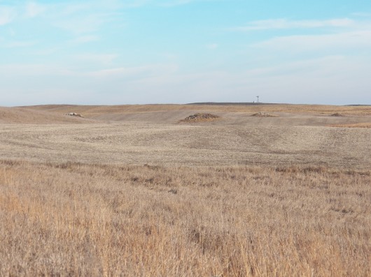
Another View of the Cropland
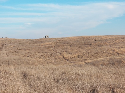
View from the NW corner looking SE
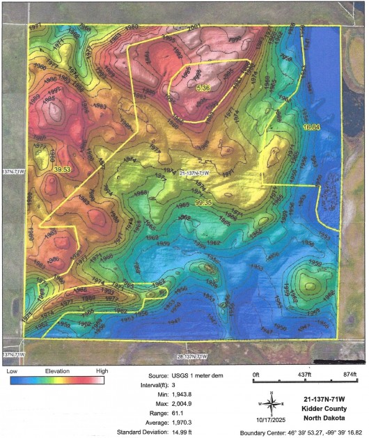
Hillshade Topography Map of Subject Land
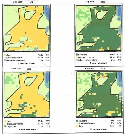
4 Year Crop History of Subject Land 2021-2024
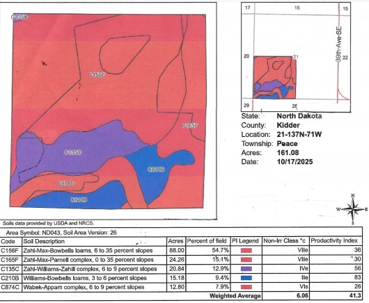
Soil Map and Legend of Subject
If you are interested in this property, please contact Prairie Rose Realty Inc. at landbroker@bektel.com or call 701-475-2784 or toll free 800-728-7558.
Prairie Rose Realty Inc. is representing the Sellers in this transaction. All information has been gathered from sources considered reliable, however cannot be guaranteed by Prairie Rose Realty Inc.
|