|
Home |
Who Are We |
Finance Companies |
North Dakota Map
165 Ac Wing Family Recreation Land For Sale
Phoenix Township, Wing, Burleigh County, North Dakota
Bring your Kayaks, Canoes and Camping Gear to this Beautiful Parcel of Recreation Lake Land perfect for all types of entertainment for the Outdoor Enthusiast, approx. 45 minutes from Bismarck, ND but still very private. Enjoyed by the Friez Family for over 25 Years, purchased for hunting Waterfowl & Deer.164.8 Acres qualifies this Quarter of Land for an annual Gratis Deer License, offering the privacy of your own Hunting Land for Waterfowl, Upland Game, Trapping and Fishing. Located in a fantastic area with large Lakes nearby, this property is just N of Lake Arena offering one-half mile of Private Shoreline. The Lake is large enough that the birds do not leave it, and is one of the last Lakes to freeze up, so late Season Hunting is phenomenal especially late Season Northern Mallards - plus there is a Waterfowl Production Area located on the West side of the Lake. Easy Access 1/2 mi off a County Road, there are 21 Tillable Acres of the 29 +/- Acres of Ground currently planted for the '23 Season. Seller's Asking $112,000 or $679/ac avg.
*********************************
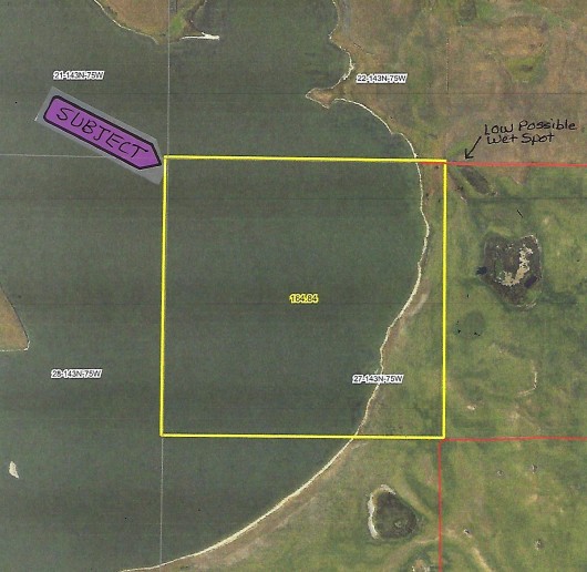
Legal Description: NW1/4 Section 27, Township 143 North, Range 75 West, Burleigh County, North Dakota as described on abstract, with Sellers reserving 50% of all Oil & Gas Minerals currently owned, if any.
Location: From Bismarck, ND travel N on Hwy. 83 to Hwy 36 and then East approx 22 mi to Wing, ND - or - from Bismarck, ND travel E on Interstate 94 to Sterling, and N on Hwy 14 to Wing, ND. From Wing, at the Junction of Hwy. 36 & 14, travel East on Hwy. 36 for 6 miles to 392nd Stl NE. Turn N and travel 3 miles to the Section Line. Turn West onto the Prairie Trail for 1/2 mi to the NE corner of the Property. Coming from the Eastern part of ND, you may go to Tuttle, ND and then travel 8 mi W on Hwy 36, then North on 392nd St. NE. During very wet seasons be mindful of a low area on the Prairie Trail right before the Property corner. (See Maps)
Acreage Breakdown:
29.41 Acres of Land & Shoreline with 21 Acres of Farmland verbally rented to a Neighbor for 2023 Season. It is up to the new Owner to rent or not after this Season's Harvest. 134.57 Acres of Lake Water.
Easements: There are NO USFW Grassland Easements, however there IS a USFW Wetland Easement on this Property that does not interfere with Agricultue, but does restrict the draining, leveling, filling or burning of Wetlands without permission from US Fish & Wildlife.This is a perpetual wildlife friendly easement and no annual payment. Sale is subject to new Owner honoring this easement.
Annual Income: The Neighbor paid the Owners $1,400 for 2 years of Rent last year. This verbal agreement ends as soon as crops are harvested this year. New Owners will decide if they want to rent it out again for next Season.
Real Estate Taxes: Most Recent Real Estate Taxes available are $83.94 per year or avg 51 cents per acre per year. This includes a 5% discount for payment by February 15th. There are No Special Assessments.
Note: FOR A VIDEO TOUR OF THIS PROPERTY, CLICK HERE.
Sellers Note to Buyers: "Over the years my family and I have harvested Canada Geese, Snow Geese, White Fronted Geese, Tundra Swans, Sandhill Cranes, all species of Ducks common in the Northern Central Flyway. This lake is one of the last lakes to freeze up yearly, so late season hunting is phenomenal especially late season Norther Mallards. The property is large enough to qualify for a yearly gratis Deer Tag also. Large Bucks are common in this area. The recreational value of this land is tremendous from lake use with kayaks, canoes, birdwatching, camping, etc. To me this parcel has been a personal, private piece of Heaven to enjoy. There is little chance for other development in the area so it is very private and secluded."
Seller's Asking $112,000 or $679/acre average
Aerial Map of Subject Land Outlined in Yellow
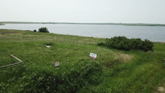
Drone View of the Property from the NE corner looking SW from the Access Trail
.jpg)
Drone View from the NE corner looking S
.jpg)
Drone looking S from the N side of the Cropland
.jpg)
Drone View from the SE corner of Subject Property looking N
.jpg)
Drone View from SE corner looking W
.jpg)
Birds-eye view of the Lake from the S side of Property
.jpg)
Drone view of Shoreline from the S side of Subject Property
.jpg)
Sandy Shores
.jpg)
Drone view of Shoreline from the N side of Property looking S
.jpg)
Another Drone view of the Lake
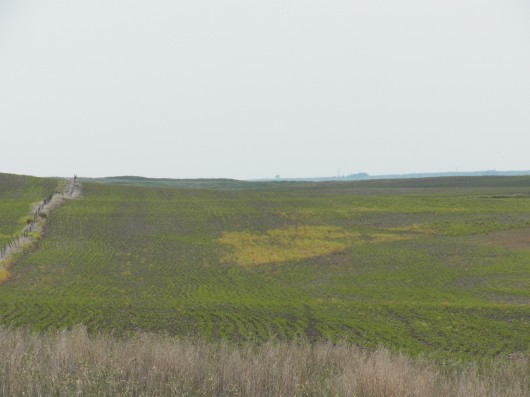
View from the NE corner of Property looking S
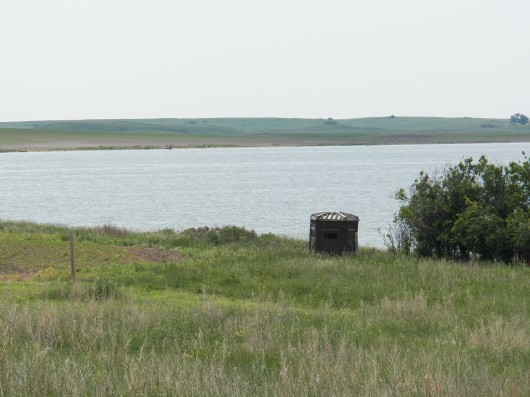
View of Hunting Blind placed along the Lake
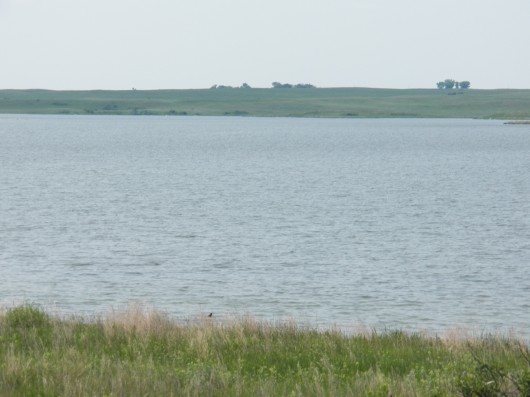
View of Lake
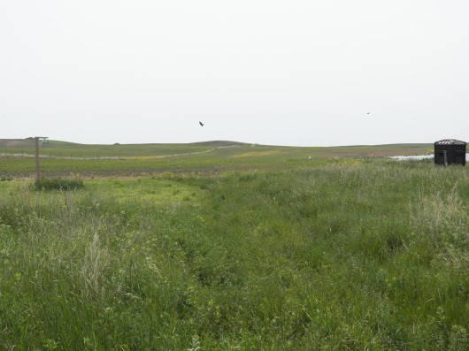
Gathering/Camping site located on N side of Property
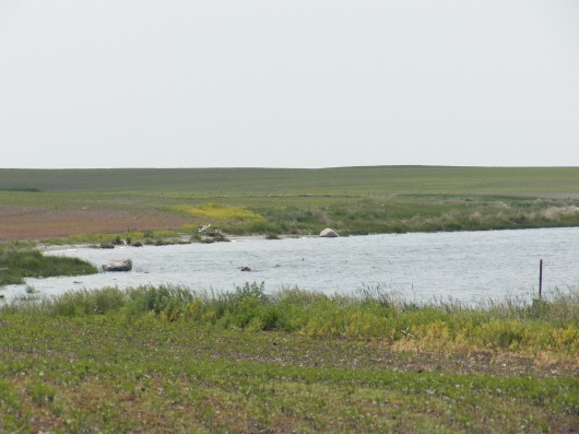
View of Shoreline
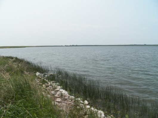
A look at Northern Shoreline w/ Lake
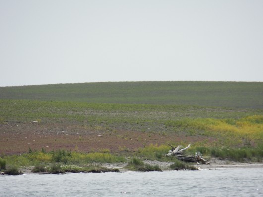
View of Southern Shoreline and Cropland
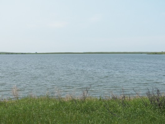
Another view of the Lake
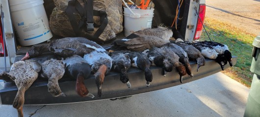
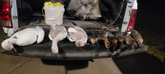
Seller Says "All of the animals shown here were taken from this Property."
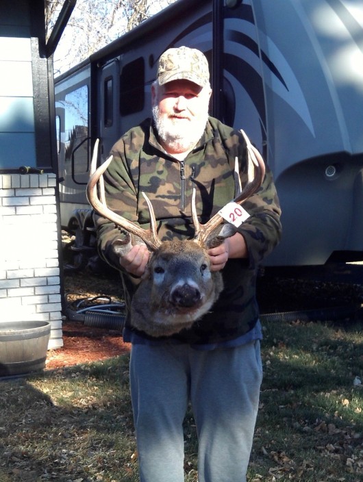
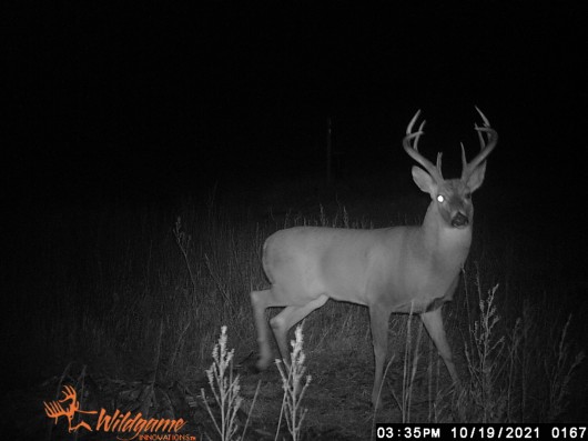
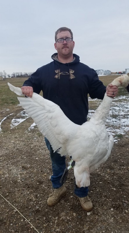
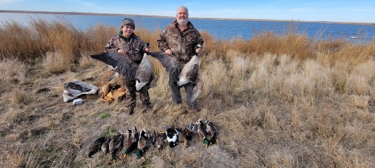
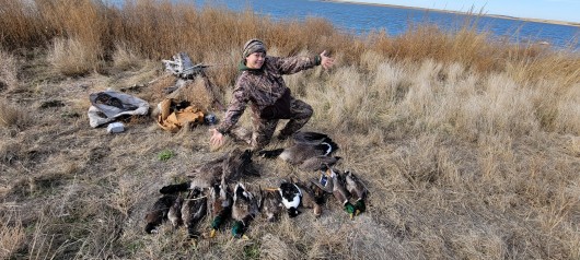
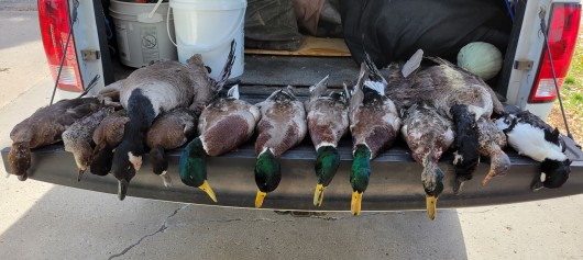
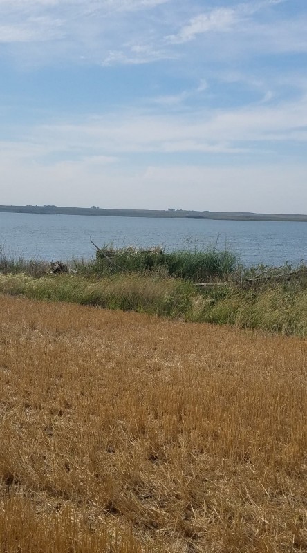
This Photo is an Above Ground Hunting Blind set up next to the Lake.
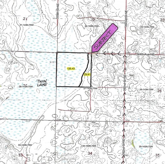
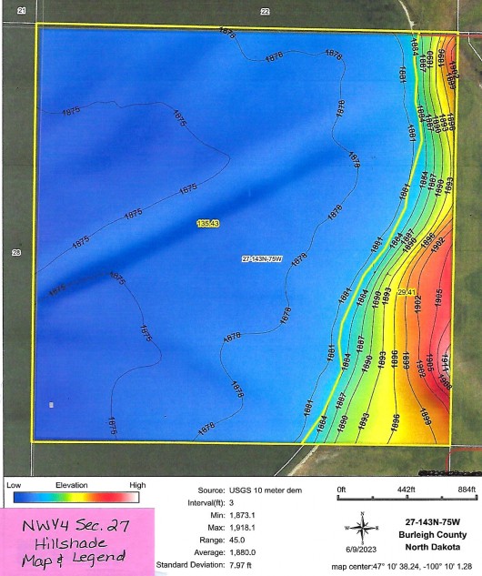
Topography Map of Subject Land Outlined in Black, and surrounding Land.
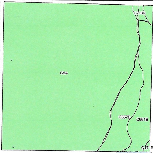
Soil Map & Legend of Land & Cropland
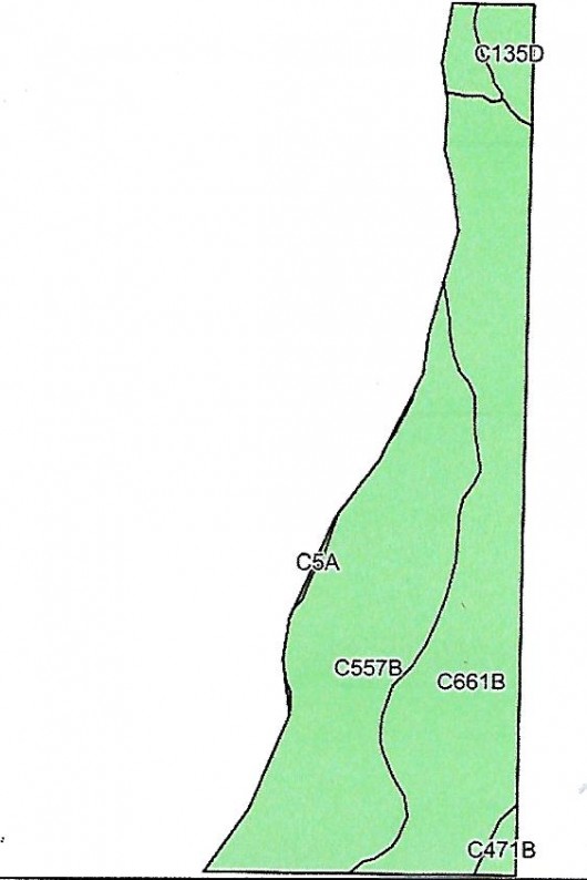

Soil Map& Legend of Overall Subject Land showing Acreage Breakdown

Hillshade Map & Legend of Subject Land
If you are interested in this property, please contact Prairie Rose Realty Inc. at landbroker@bektel.com or call 701-475-2784 or toll free 800-728-7558.
Prairie Rose Realty Inc. is representing the Sellers in this transaction. All information has been gathered from sources considered reliable, however cannot be guaranteed by Prairie Rose Realty Inc.
|



.jpg)
.jpg)
.jpg)
.jpg)
.jpg)
.jpg)
.jpg)
.jpg)
.jpg)


