|
Home |
Who Are We |
Finance Companies |
North Dakota Map
1,900 Ac Stutsman Ranch For Sale
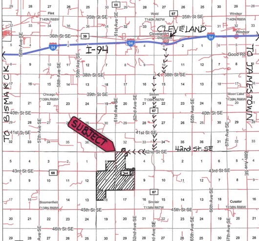
6147 42nd Street SE, Cleveland, Stirton & Sinclair Twp., Stutsman County, North Dakota
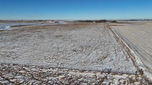
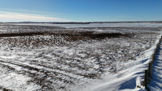
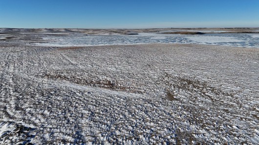
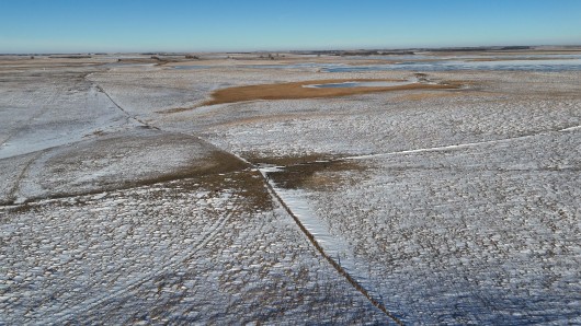
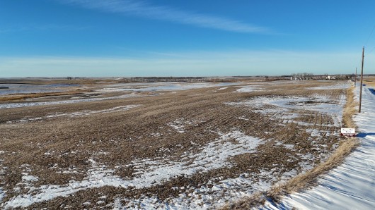
1,900 Deeded Acres all in One Block. Introducing a condensed version of the Vandeberghe Flying V Angus Ranch with a mix of Cross Fenced Native Pasture, plentiful Water Resources, Hay Ground and diverse Widlife Habitat, just a few miles S of I-94 West of Jamestown, in Stutsman County. 1,340 Acres of Livestock Grazing Ground and Water Holes plus the 320 Ac Fenced Hayland for Fall Grazing, making this property ideal for a productive Livestock Operation. Working Faciltiies include 60'X128' Working Barn, Calving Barn w/Elec Power, 3 Calving Pens w/LED Lights, Well Planned Corral System w/Windbreaks, Alley & Load-Out Chute, Panels & Gates, Livestock Well, on 5 Ritchie Waterers & 2 Tank Tires on Slabs, all necessary for successful management. Ready for 2025 Grazing, the entire property has perimeter 4 Wire Fences and 3 Wire Cross-fencing into 8 Cells plus 2 add'. Leased Pastures w/Operator Owned Double Fenced Bull Pasture, each w/access to Water ensuring efficient Grazing and Rotation Management. These improvements make it well-suited to support the Owner-rated 320 Pairs plus 60-70 Replacement Heifers capacity year-round. Main Headquarters on 18 Ac on the N side of Road includes nice 2000 3 Bedroom/2 Bath Ranch Home w/lots of extras, 3 Stall Garage, Machine Storage Shop, Grain Bins, Garden Shed, Heated Livestock/Equine Show Barn w/Vet-Tack Room. Add'l. 4 Ritchie Waterers all on it's own Rural Water source. Located in the Heart of the Coteau Rangeland aka Prairie Pothold Region crossed by the Migration Flyway w/gentle rolling Hills, dense mature Trees & Balch Slough enhances its Seclusion and Privacy. Easy Access to I-94 just 60 minutes to Bismarck and 20 minutes to Jamestown, ND. Seller's Asking Appraised Value of $3,852,000, at $2,027/ac avg.
*********************************
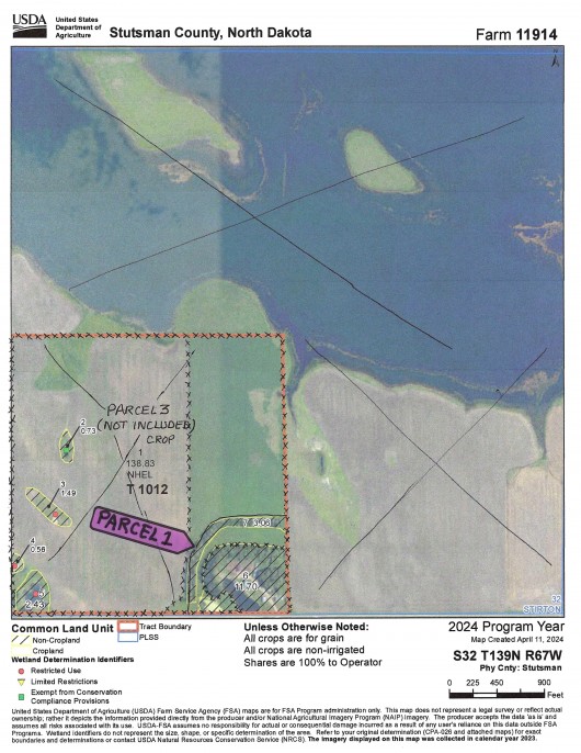
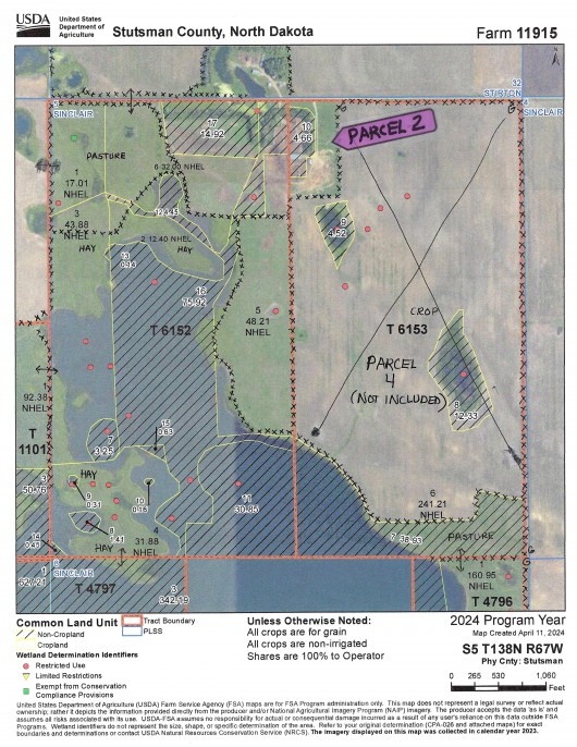
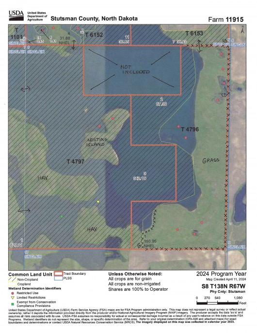
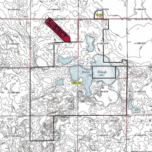
Legal Description: Section 32-T139N-R67W: 18 Acres, surveyed out of the SE1/4 SW1/4 aka Parcel 1. Balance of SW1/4 aka Parcel 3 is reserved by Sellers. Section 5-T138N-R67W: 5 Acres W1/2 NW1/4 NW1/4 NE1/4; 151.22 Acres, S1/2 NW1/4 & Govt Lots 3 & 4 (FR NW1/4); 160 Acres, SW1/4; E1/2 w/248 +/- Ac Cropland surveyed out and reserved by Sellers. Section 6-T138N-R67W: 160 Acres, SE1/4.Section 7-T138N-R67W: 158 Acres, NE1/4; 77.12 Acres, NE1/4 NW1/4 & Govt Lot 1 (FR N1/2 NW1/4); 77.37 Acres, SE1/4 NW1/4 & Govt Lot 2 (FR S1/2 NW1/4); 155.49 Acres, E1/2 SW1/4 & govt Lots 3 & 4 (FR SW1/4); 160 Acres, SE1/4.Section 8-T138N-R67W: 120 Acres, NE1/4 NE1/4 & S1/2 NE1/4; 120 Acres, W1/2 NW1/4 & SE1/4 NW1/4; 160 Acres, SW1/4; 120 Acres, NE1/4 SE1/4 & S1/2 SE1/4; 40 Acres, NW1/4 SE1/4.Section 18-T138N-R67W: 155.35 Acres, E1/2 NW1/4 & Govt Lots 1 & 2 (FR NW1/4).Section 9-T138N-R67W: 160 Acres, SE1/4 reserved by Sellers.
Location: From Bismarck travel East on Interstate 94 to Exit 238 (Cleveland Exit 78 Mi) or from Jamestown, ND travel 22 Mi West on I-94 to Exit 238. turn S at Exit and travel South on Hwy. 67 following the curve for 6 Mi to 42nd Street SE. Turn West and travel 1 Mile to the NE corner of the Property. (See Map)
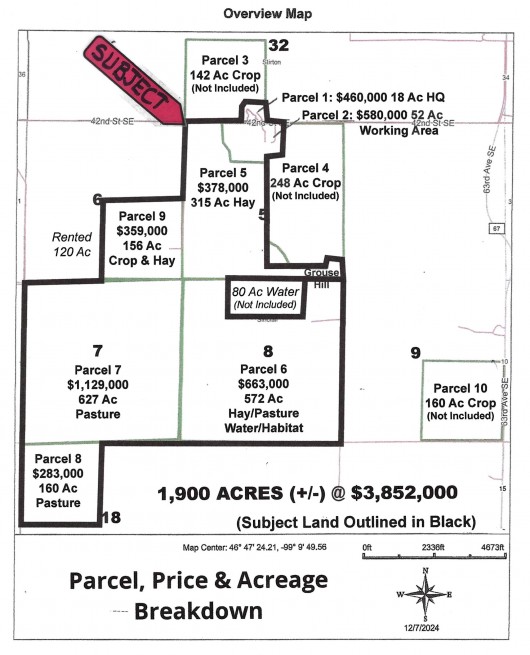
Acreage Breakdown:
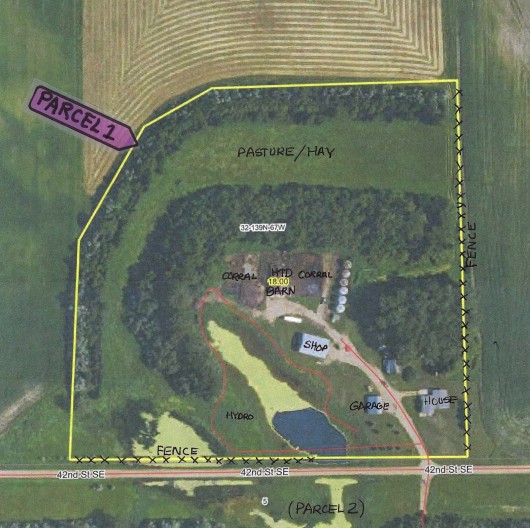
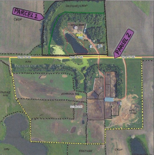
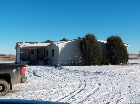
PARCEL 1: Described Parcel 1 as 18 +/- Ac in the SW1/4 in Section 32, including Headquarter (HQ) Buildings, Township 139 North, Range 67 West at $460,000.00. HQ includes 3 Bedroom Ranch Home, 3 Stall Garge, Grain Bins, Machine Shop Storage, Garden Shed and Heated Livestock/Equine Show Barn w/Vet-Tack Room and 4 Ritchie Waterers & Lines on it's own Rural Water Membership source.
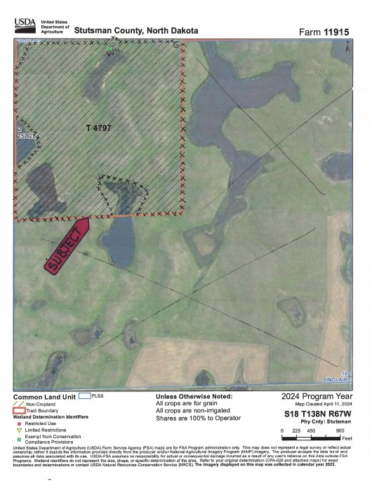
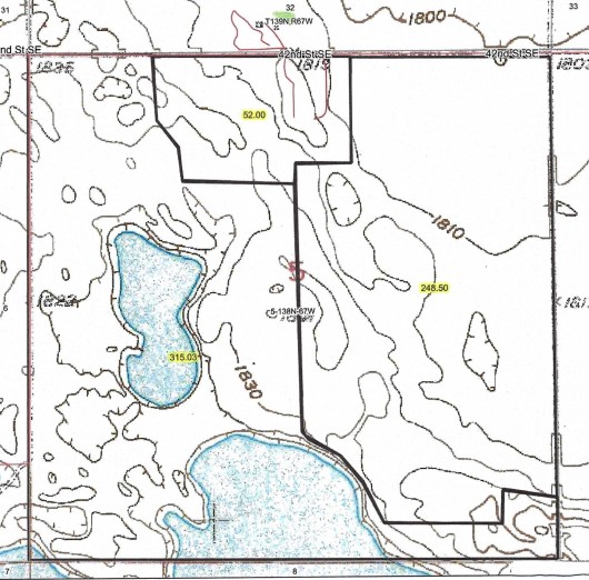
PARCEL 2 & 5: Described as Parcel 2 in the NE corner of the E1/2 of Section 5, including Corral System, Buildngs and Livestock Well & Waterers for Calving, Wintering and Working Cattle, plus the Pasture in NE1/4 NW1/4 Section 5, consisting of 52+/- Acres with a Fair Market Value of $580,000. Parcel 5 also in Section 5 is described as 282 Ac in balance of W1/2 partial E1/2 of Section 5, Township 138 North, Range 67 West, Stutsman County consisting of additional acres of Pasture, 136.37 Ac Fenced Hayland and 127 Acres of Open Water for a Fair Market Value of $378,000.00 sbject to new Owner honoring USFW Wetland & Grassland Easements.
PARCEL 3: Described as the SW1/4 in Section 32, Township 139 North, Range 67 West, Stutsman County, consisting of 148 +/- Ac with 138.83 Tilled Acres. This property has a Fair Market Value of $658,000.00 with overall average is $4,476/ac.RESERVED BY SELLERS TO LEASE.
PARCEL 4: Described as Part if the E1/2 in Section 5, Township 138 North, Range 67 West, Stutsman County, consisting of 246 +/- Ac with 241.21 Tillable Acres. This property has a Fair Market Value of $893,000.00 with overall average is $3,630/ac. RESERVED BY SELLERS TO LEASE.
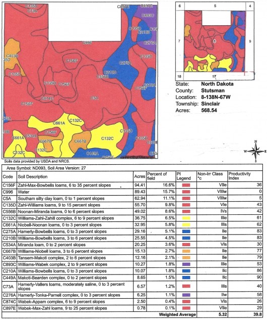
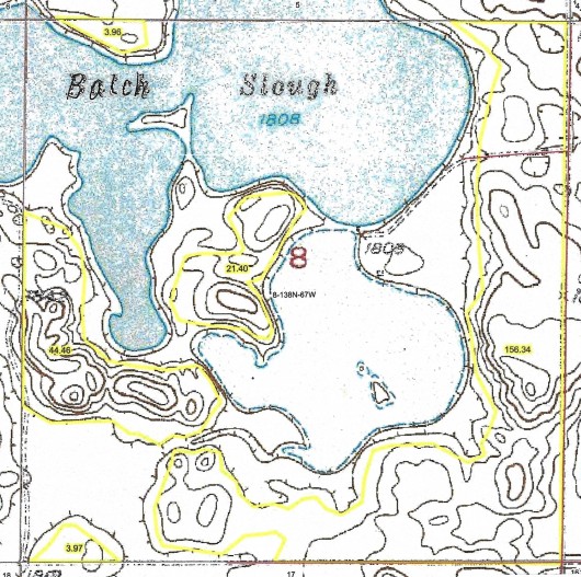
PARCEL 6: Described as 560 Acres in Section 8, Township 138 North, Range 67 West, Stutsman County, full Section less the 80 Ac of Open Water owned by Stutsman County Wildlife Federation consisting 232 Ac Pasture & Hayland and approx. 315 Ac Open Water for a Fair Market Value of $663,000.00. Subject to new Owner honoring USFW Wetland & Grassland Easements.
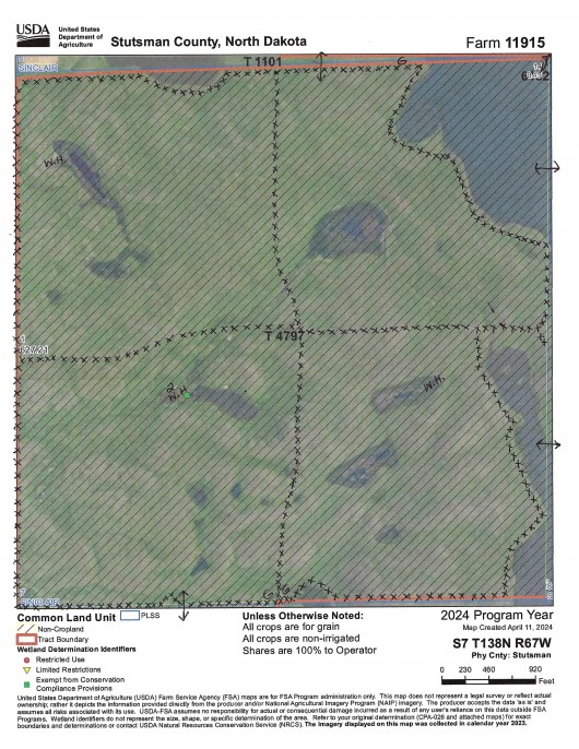
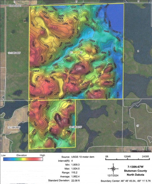
PARCEL 7: Described as 627.98 Acres, All of Section 7, Township 138 North, Range 67 West, Stutsman County, consisting of all Pasture, Cross Fenced and Livestock Water for a Fair Market Value of $1,129,000.00, subject to new Owners honoring USFW Wetland & Grassland Easements.
PARCEL 8: Described as Owners favorite Pasture, 155.35 Acres in NW1/4 Section 18, Township 138 North, Range 67 West, Stutsman County, consisting of all Pasture, Fenced & Livestock Water for a Fair Market Value of $283,000.00 and subject to new Owner honoring USFW Wetland and Grassland Easements.
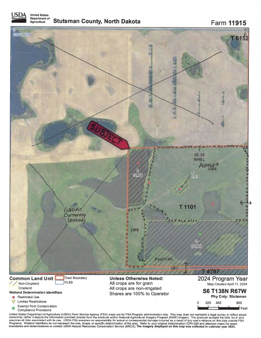
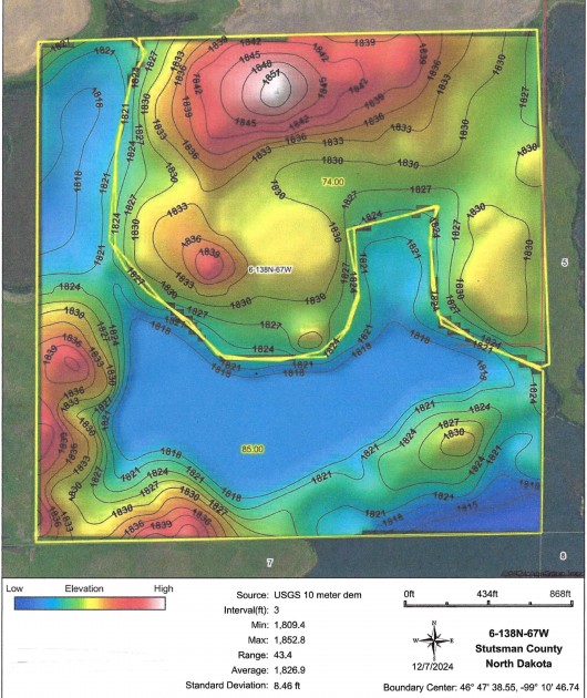
PARCEL 9: Described as 160 Acres in SE1/4 Section 6, Township 138 North, Range 67 West, Stutsman County, consisting of 83.5 Tillable acres planted to Alfalfa, 20 Acres of Pasture and 72 Acres Open Water for a Fair Market Value of $359,000.00. Subject to new Owner honoring any USFW Wetland & Grassland Easements on Grass & Water, if any.
PARCEL 10: Described as the SE1/4 in Section 9, Township 138 North, Range 67 West, Stutsman County, consisting of 157.48 Ac with 142.6 Tillable Acres. This property has a Fair Market Value of $560,000.00 with overall average is $3,556/ac.RESERVED BY SELLERS TO LEASE.
NOTE: Cropland Prices are broken down as $4,700/ac for Class II Soil Cropland 68+ PI, $3,900/ac for Class II Soil Cropland 50-67 PI, $2,800/ac for Class III & IV 26-49 PI & 780/ac for lower PI, Wetland in Cropland, Open Water & Other. Pasture with Livestock Water & Fences is $1,800/ac and subject to new Owner honoring USFW Wetland & Grassland Easements. All Open Water has a value of $780/acre. This land to be offered with the Seller’s reserving 100% Oil & Gas Minerals currently owned, if any.
Easements: There IS an USFW Wetland Easement on this Property which restricts burning, draining, leveling or filling of Wetlands without permission. There IS also an USFW Grassland Easement on the Pasture and Hayland that restricts farming but does NOT interferre with Grazing but does restrict Haying until after July 15th. These Easements are perpetual and the Sale is Subject to new Owner(s) honoring these Easements of Record.
Annual Income: There are No Current Leases on this Land, but there are good Renters available. Sellers will be Leasing Cropland with First Option going to New Owners of the 1,900 Acres if sold in timely manner for 2025 Growing Season.
Real Estate Taxes: Section 32-T139N-R67W: 18 Acres, SE1/4 SE1/4 SW1/4; 138 Acres, SW1/4 less SE1/4 SE1/4 SW1/4. Taxes are $1,513.65/year which includes 5% Discount. No Specials. Cropland Acre Taxes will be deducted. Section 5-T138N-R67W: 5 Acres W1/2 NW1/4 NW1/4 NE1/4; 151.22 Acres, S1/2 NW1/4 & Govt Lots 3 & 4 (FR NW1/4); 160 Acres, SW1/4; 147.02 Acres, S1/2 NE1/4 & GL 1 & 2 (FR NE1/4) less W1/2 NW1/4 NW1/4 NE1/4; 160 Acres, SE1/4. Taxes are $2,554.31/year which includes 5% Discount. No Specials. Cropland Acre Taxes will be deducted. Section 6-T138N-R67W: 160 Acres, SE1/4. Taxes are $799.37/year which includes 5% Discount. No Specials. Section 7-T138N-R67W: 158 Acres, NE1/4; 77.12 Acres, NE1/4 NW1/4 & Govt Lot 1 (FR N1/2 NW1/4); 77.37 Acres, SE1/4 NW1/4 & Govt Lot 2 (FR S1/2 NW1/4); 155.49 Acres, E1/2 SW1/4 & govt Lots 3 & 4 (FR SW1/4); 160 Acres, SE1/4. Taxes are $1,591.79/year which includes 5% Discount. No Specials. Section 8-T138N-R67W: 120 Acres, NE1/4 NE1/4 & S1/2 NE1/4; 120 Acres, W1/2 NW1/4 & SE1/4 NW1/4; 160 Acres, SW1/4; 120 Acres, NE1/4 SE1/4 & S1/2 SE1/4; 40 Acres, NW1/4 SE1/4. Taxes are $923.14/year which includes 5% Discount. No Specials. Section 9-T138N-R67W: 157.48 Acres, SE1/4 Less HY. Taxes are $1,099.62/year which includes 5% Discount. No Specials. These taxes will stay with Seller. Section 18-T138N-R67W: 155.35 Acres, E1/2 NW1/4 & Govt Lots 1 & 2 (FR NW1/4). Taxes are $402.58/year which includes 5% Discount. No Specials.
Note: FOR A DRONE VIDEO OF THIS PROPERTY, CLICK HERE.
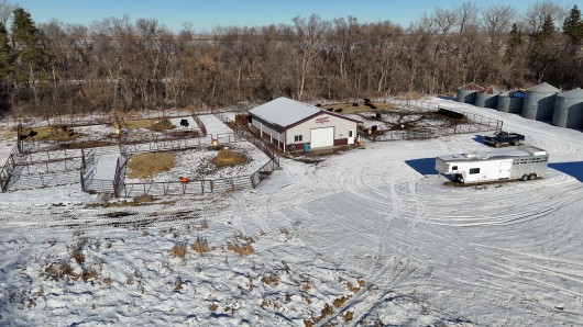
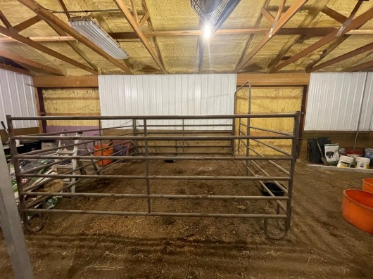
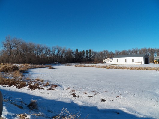
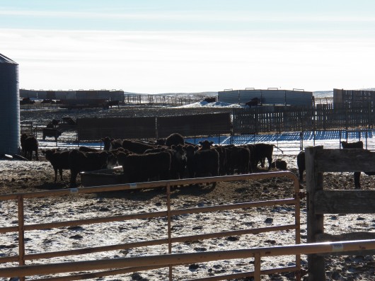
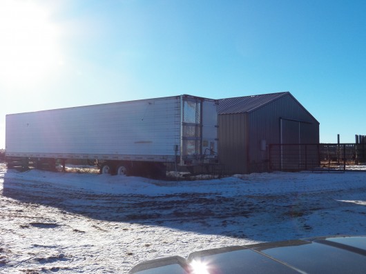
IMPROVEMENTS: Main Headquarters aka Parcel 1 on North Side of the Road has a very nice 2000 3 Bedroom/2 Bath Triple Wide Schult Ranch Home w/new Addition Entry/Mudroom. New Siding, Roofing and Tinted Windows in 2020, new Sliding Door & Deck, Stainless Appliances, Vaulted Ceilings and Open Concept on Piers w/30 Anchors. Also includes 3 Stall Detached Garage w/Steel Siding, 10'X12' Garden Shed, Cold Storage Machine Shop, 3 - 3,200 bu Bins w/Air, 4 sm. Bins, Heated Livestock/Equine Show Barn w/Pens, Entry & Vet-Tack Room. Insulated w/Spray Foam Roof & Batt Insulation in Walls. There are 4 Ritchie Waterers & Lines throughtout on Rural Water Membership. Septic System is 750 Gal. Tank w/3 Runs (Drainfield) between House & Road, built same year as Home. LP Tanks are included. Working Facilites in Section 5 aka Parcel 2 on South Side of the Road include 60'X128' Working Barn, Calving Barn w/Electric Power, 3 Calving Pens w/LED Lights, Well Planned Corral System w/large Wood Posts, Windbreaks, Liquid Feeder, Alley & Load-Out Chute, Panels and Gates making it well suited to support capacity year-round. This Ranch is located in the Heart of the Coteau Rangeland aka Prairie Pothole Region crossed by the Migration Flyway with gentle rolling hills, dense mature Trees & Balch Slough providing additional opportunities and enhancing its seclusion and privacy. Thanks to Easy Access to Interstate 94, this Region offers convenience for both Domestic and International Travel. North Dakota's Capital City, Bismarck, is a quick 60 minute drive to the West, while full service Jamestown, ND is only 20 minutes to the East. UTILITIES: Main Headquarters is enrolled in Rural Water Membership which will be transferred to new Owner upon change of Ownership. The Working Headquarters has a Livestock Well approx. 110 ft. West of the Chute. Property has Private Septic System and Heating Source is Propane. There are two 500 Gallon Tanks and one 1,000 Gallon Tank on premise. **Sellers are looking to sell their Machinery, Livestock Equipment and their Angus Livestock.
Seller's Asking Appraised Value of: $3,852,000. or $2,027/ac avg. Seller intends to perform and IRS 1031 Exchange with the Proceeds at Sellers Expense and buyer agrees to cooperate with Sellers Intermediary in the Exchange.

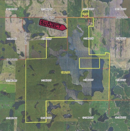
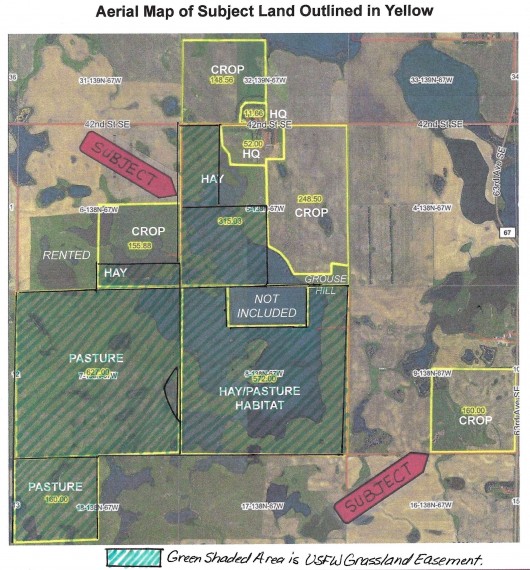
Aerial Map of Full Acreage Outlined in Yellow
Aerial Map of Headquarters Parcel 1 (N) on Surveyed 18 Acres +/-
Aerial Map of Section 32 w/Parcel 1 Outlined in SE Corner
Aerial Map of Parcel 2 in Section 5 Showing Cattle Working System
Aerial Map of Section 5 showing Parcels 2 & 5 (Parcel 4 is Reserved)
Aerial Map of Section 8 showing Parcel 6 (less 80 Ac Water)
Aerial Map of Section 7 showing Parcel 7, all Pasture
Aerial Map of Section 18 showing Parcel 8 in NW1/4
Aerial Map of Section 6 showing Parcel 9 in SE1/4 plus 120 Ac Rented Land to W
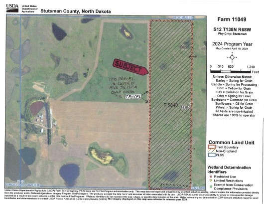
Aerial Map of Rented Parcel that Seller Owns Fences to pass on to new Owner. Fences are marked with XXXXX. Gates are marked with G and Dugouts marked with W.H.
PARCEL 1: DRONE VIEW LOOKING UP DRIVEWAY.

Parcel 1: Drone view of the Machine Shed
Parcel 1: Drone view of the Show Barn
Parcel 1: Main HQ w/Home in Section 32

Parcel 1: View of Ranch Home, South side.
Parcel 1: 2nd View of Home, West side entrance
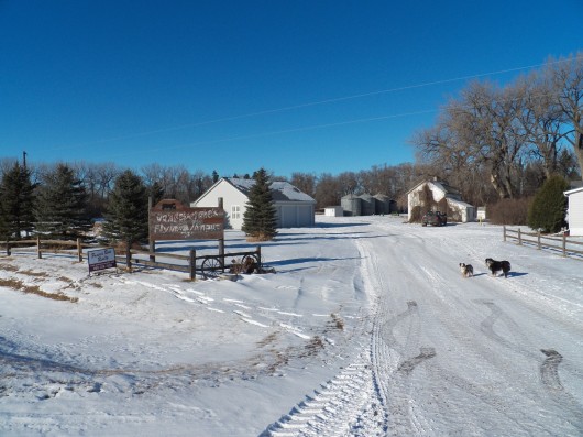
Parcel 1: Entering HQ. Home on Right, Garage, Shop & Show Barn on Left

Parcel 1: Triple Garage w/Auto Openers across from Home
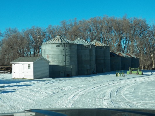
Parcel 1: Grain Bins and Garden Shed

Parcel 1: Machine Shop
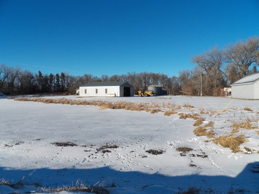
Parcel 1: 2nd View of Machine Shed from Road
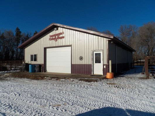
Parcel 1: Show Barn/Private Sale Barn
Parcel 1: Show Barn Holding Corrals, East side
Parcel 1: Alley into Pass-Thru Doors in Show Barn
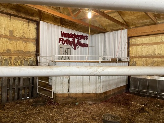
Parcel 1: Auctioneer Stand interior Show Barn
Parcel 1: Interior of Show Barn
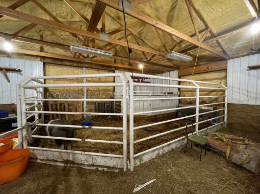
Parcel 1: Interior Pens in Show Barn
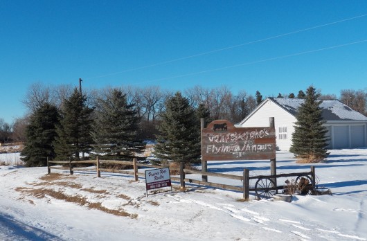
Parcel 1: Front Entry on Road
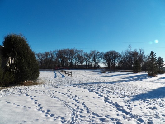
Parcel 1: West side yard and Waterway

Parcel 1: Pasture between Tree Rows. Ritchie Waterer. Protection for Equine.
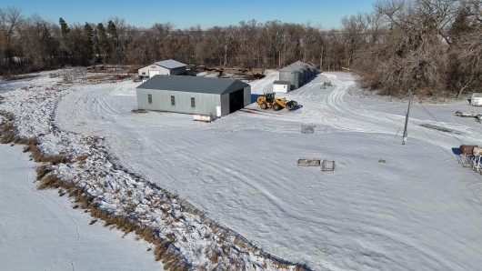
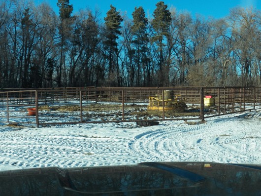
PARCEL 2: BIRDS EYE VIEW OF WORKING BARN & CORRALS
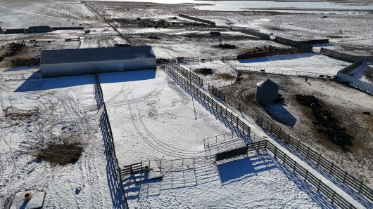
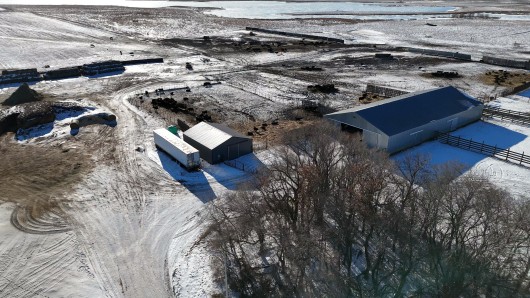

Parcel 2: Drone view of Corrals
Parcel 2: Working HQ, Center Alley to large Working Barn
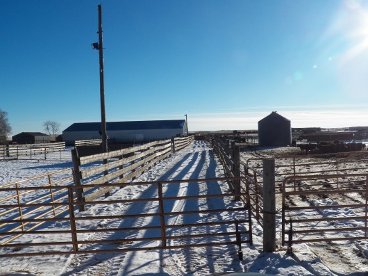
Parcel 2: Livestock Corrals

Parcel 2: Windbreaks in Corrals

Parcel 2: Loading Chute

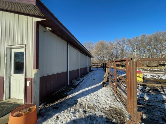
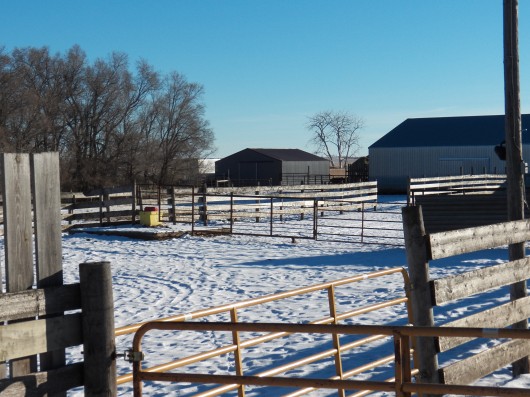
Parcel 2
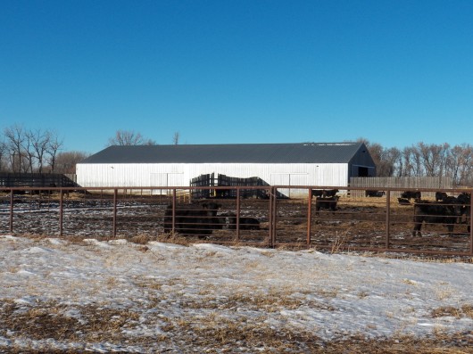
Parcel 2: Long Livestock Building
Parcel 2:

Parcel 2

Parcel 2: Working Barn
Parcel 2
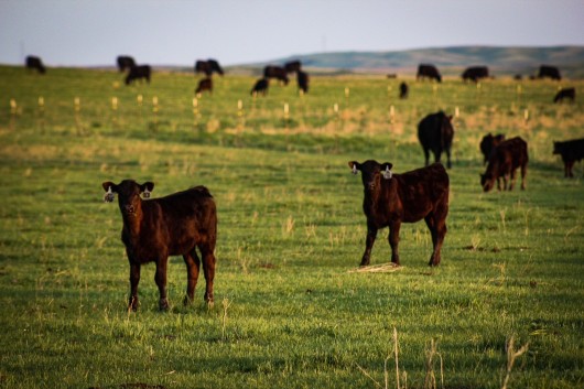
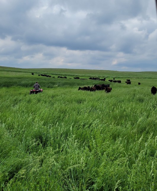
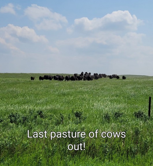
Spring Photos of Pasture
Spring Pasture
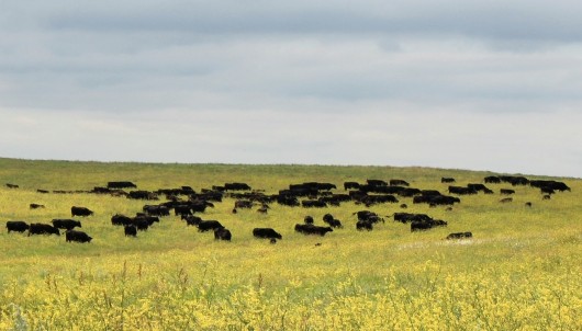
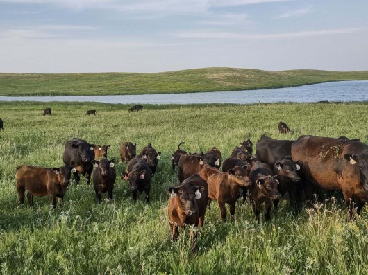
Summer Pasture
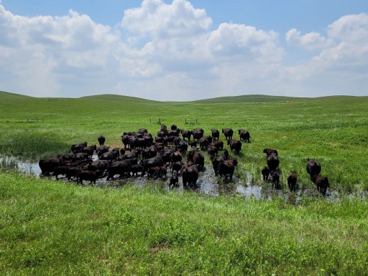
Summer Pasture
Summer Pasture
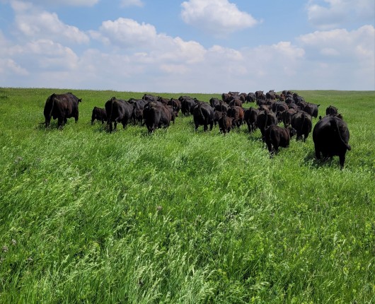
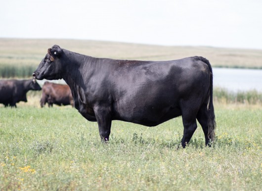
Summer Pasture Flying V Ranch
Summer Pasture Flying V Ranch
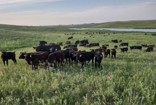
Late Summer Pasture Flying V Ranch
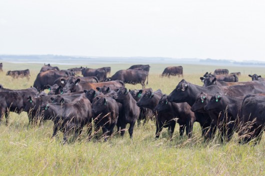
Late Summer Pasture Flying V Ranch
Late Summer Pasture Flying V Ranch
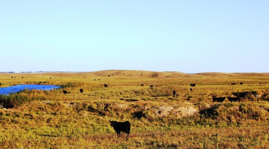
Late Summer Pasture Flying V Ranch
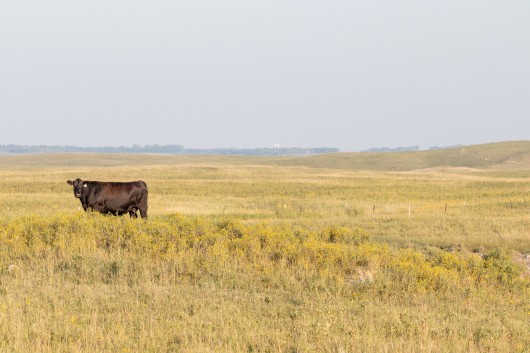
Late Summer Pasture Flying V Ranch
Parcel 4: Birds eye view from the NE corner looking SW
Parcel 4: Drone view from the SE corner looking W

Parcel 4: SE corner looking West

Parcel 4: Cropland on E1/2 Section 5. Looking to Working Barns
PARCEL 5: DRONE VIEW FROM THE SE CORNER LOOKING N
PARCEL 6: DRONE VIEW FROM THE NE CORNER LOOKING SW
Parcel 6: Drone view from the SE corner looking W
PARCEL 7: DRONE VIEW OF SECTION 7, ALL PASTURE

Parcel 7: Drone view Cross Fencing in Section 7
PARCEL 10: DRONE VIEW FROM se CORNER LOOKING N/NW

Parcel 10: Drone view from the NW corner looking E
Topography Map of Total 1,900 Acres
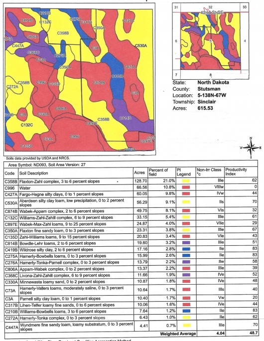
PARCEL 5: SOIL MAP & LEGEND SECTION 5 OA
PARCEL 4 & PARCEL 5: HILLSHADE TOPOGRAPHY SEC 5
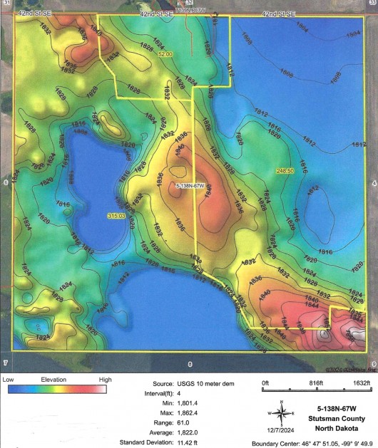
PARCEL 2, 4 & 5: TOPOGRPAHY MAP OF SECTION 5
PARCEL 6: SOIL MAP & LEGEND SECTION 8
PARCEL 6: HILLSHADE TOPOGRAPHY SECTION 8
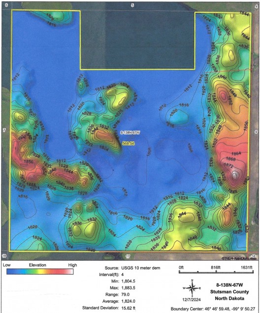
PARCEL 6: TOPOGRAPHY MAP OF SECTION 8
PARCEL 7 & 8: SOIL MAP & LEGEND SECTIONS 7 & 18

PARCELS 7 & 8: HILLSHADE TOPO. SECTIONS 7 & 18
PARCEL 9: SOIL MAP & LEGEND SE SECTION 9

PARCEL 9: HILLSHADE TOPOGRPAHY SE SECTION 6
Aerial Map showing USFW GE shaded in Green Stripes
This Ranch is shown by Appointment Only to pre-Qualified Buyers. Please contact Naomi Turner @ 701-220-3835 or landbroker@bektel.com or Chauncey Turner @ 701-220-3430 or landman@bektel.com with Questions or to schedule an Appointment for Viewing. Thank you.
Prairie Rose Realty Inc. is representing the Sellers in this transaction. All information has been gathered from sources considered reliable, however cannot be guaranteed by Prairie Rose Realty Inc.
|